How BeSafe works

The right information, in the right hands, at the right time

Knowledge based on verified, accurate data is priceless. At the core of the BeSafe Building Safety System are verified, accurate digital maps of your indoor spaces, a powerful component of any comprehensive safety plan.

Why it works

What makes our safety system so powerful?

The BeSafe Safety Portal on a phone
  • Instant distribution of vital information

    Rapidly distribute accurate, up-to-date building information to all first responders, information that is essential to protecting students and staff.

  • Interactive digital floor plans

    With instant access to a building's digital floor plan and photos, emergency personnel can quickly determine the safest routes to any area.

  • Empowering first responders

    Gives fire personnel access to critical information, locations of hazardous materials, utility shut-offs, emergency contact data, and alternate approaches if primary routes are blocked.

  • The safest way in and out

    Equips EMTs to identify the most direct path to an emergency. Knowledge of windows and roof accesses improves their ability to respond to changing conditions.

  • Full agency cooperation

    Enables multiple municipal and state agencies to coordinate responses. All first responders look at the same data, helping them communicate and work together.

The platform

Built around the BeSafe Building Safety Portal

BeSafe digital floor plan of a hospital second floor on a laptop

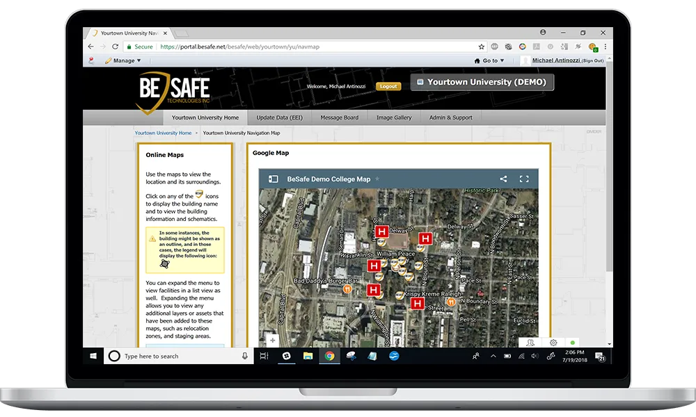
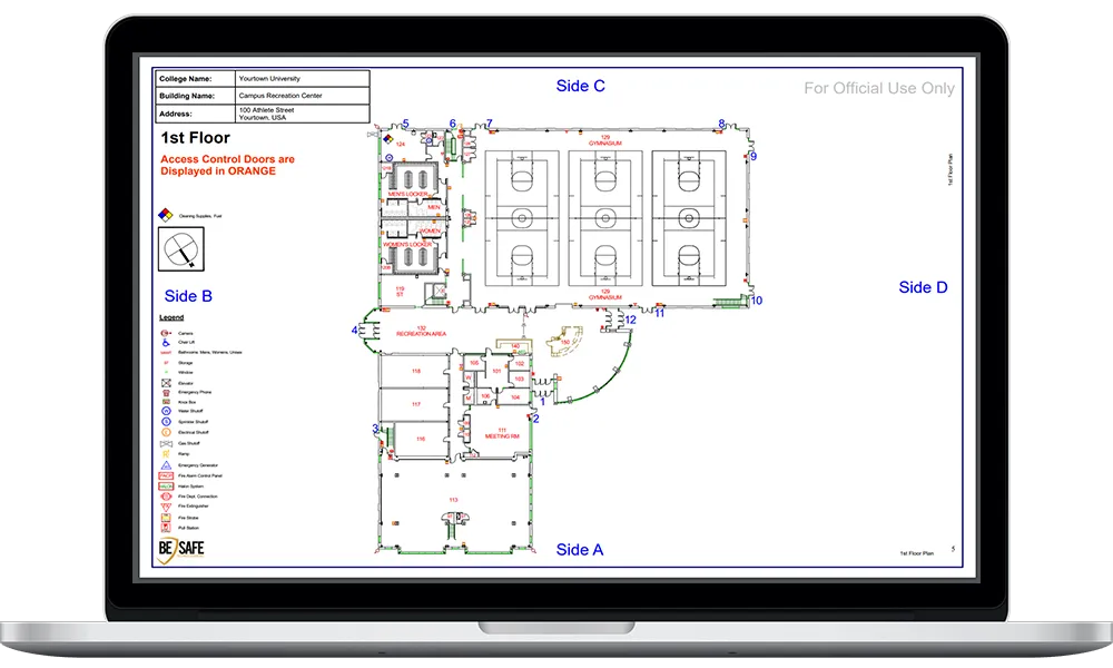
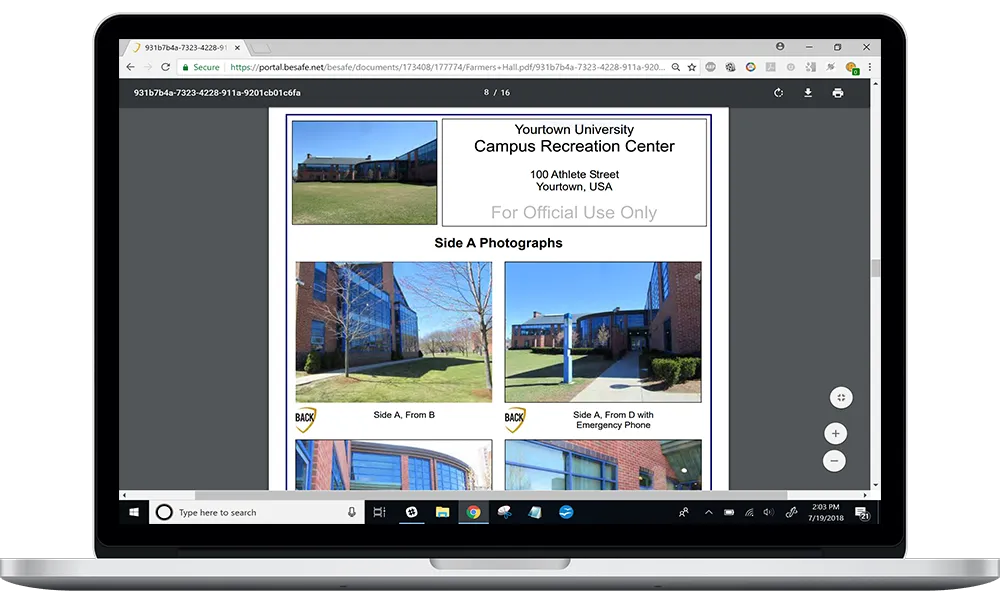
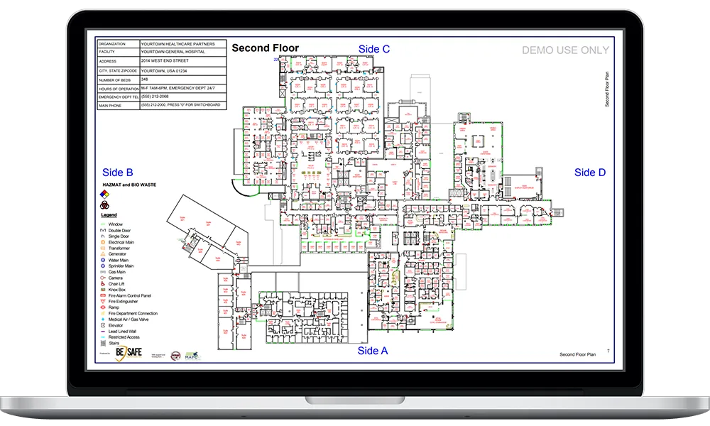
Enhanced floor plans for first responders

Unrolling stacks of architectural plans on the hood of a vehicle takes valuable time away from responding to an incident. Our interactive digital floor plans are created in vector PDF format, crisp, easily enlarged and searchable with the click of a button.

BeSafe aerial map and location view on a laptop

A centralized home for safety planning

The more accurate information is, the more useful it is. Out-of-date information is more than a nuisance, it can be dangerous. We start with verified, accurate data and enable periodic updates to maintain integrity and keep your safety plan effective.

BeSafe floor plan with access-control routes on a laptop

Evacuation maps

Posted throughout a building, evacuation maps give staff and visitors clear visual routes to exit in an emergency and mark the locations of emergency equipment for first responders. When seconds count, communication is critical.

BeSafe site photographs and safety screening on a laptop

Rapid safety assessment

BeSafe conducts a visual screening of buildings at a client site, standalone or as part of developing floor plans. Results identify the risk level of a single building, or the relative risk across a site, helping clients allocate limited risk-management resources.

Recognized by experts

The BeSafe system clearly demonstrated the critical need to integrate technology, data, and people into one comprehensive solution that will help make our country safer. This solution was seamless, simple, and may potentially save the lives of both first responders and those in harm's way.

Chuck Brooks Technology Assessment Lead, GSN IT Security Awards

Get started

See how BeSafe keeps your people safer

Talk with our team about an emergency response plan tailored to your facility: schools, campuses, hospitals, government and commercial sites.